What North York is known for
North York functions as a northern district within Toronto, home to over 600,000 residents in an area that operates more as a residential and commercial zone than a tourist destination. The district stretches from Highway 401 northward to Steeles Avenue, bounded by the Humber River to the west and Victoria Park Avenue to the east, with Yonge Street running as its central spine. What distinguishes North York is its postwar planning legacy—particularly Don Mills, one of Canada's first comprehensively planned communities—and its role as a transition zone between downtown Toronto and the suburbs beyond.
A Planned Suburb's Evolution
North York's political existence began with a grievance. By the early 20th century, York Township's northern residents—farming communities in places like Emery, Downsview, and Newtonbrook—paid nearly 23 per cent of township taxes but received negligible representation from a council focused entirely on urban issues in the south. In 1921, residents formed a committee to explore municipal division. By June 1922, North York Township formally separated, adopting the motto "Progress with Economy".
The transformation arrived after the Second World War. Developer E.P. Taylor assembled roughly 2,000 acres of farmland by 1950 and commissioned planner Macklin Hancock to design Don Mills, a planned community organised into four quadrants radiating from a central shopping complex. The homes, built in modernist style and arranged on deliberately winding roads, broke from Toronto's rigid street grids. Don Mills became a model that influenced postwar suburban planning across North America and remains visually distinctive today.
North York became a borough in 1967 during Metropolitan Toronto's reorganisation, gained city status in 1979, and was folded back into Toronto as an administrative district in 1998, where it remains.
The Landscape Today
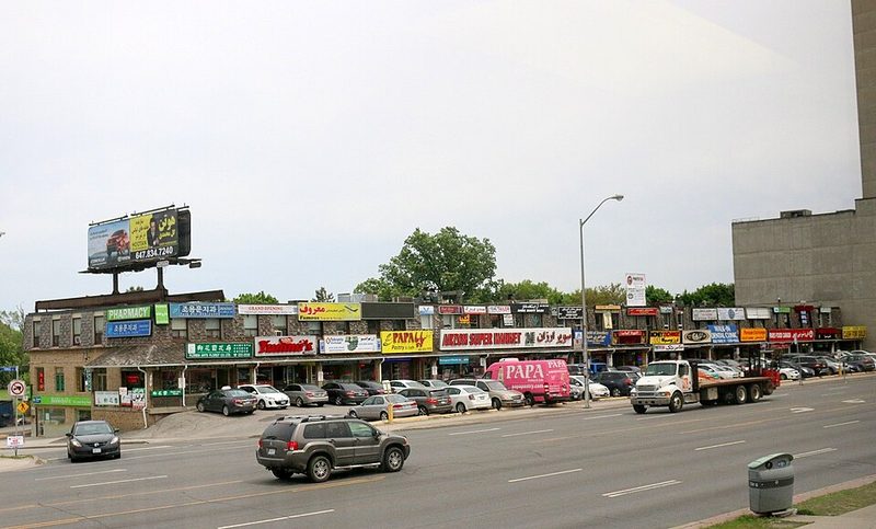
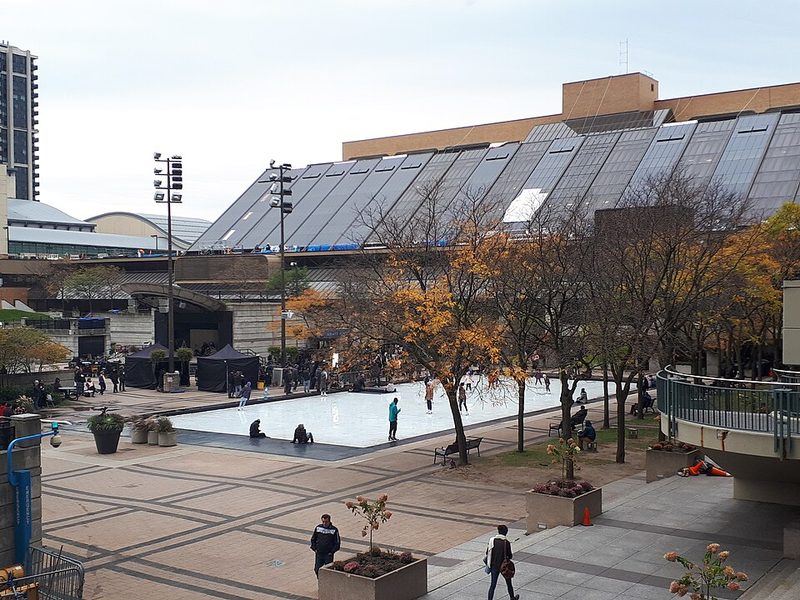
The built environment reflects the district's postwar bones. Tree-lined streets curve through established residential neighbourhoods. Shopping centres from the 1950s and 1960s line major corridors. Modernist homes sit set back from winding roads in Don Mills. Yonge Street carries commercial activity, regional bus service, and connects to Toronto's broader transit network. The North York Centre area, clustered around Yonge and Sheppard, functions as a commercial and office hub with shopping centres, restaurants, and direct subway access.
Green spaces exist throughout the district. Edwards Gardens, part of the Toronto Botanical Gardens, offers walking trails and picnic areas along the East Don River. Earl Bales Park includes trails and winter skiing. The Finch Corridor recreational trail runs from Finch and Yonge westward. These spaces are interspersed within the residential fabric rather than dominating the landscape.
Practical Orientation
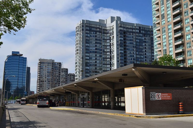
North York integrates into Toronto's transit and highway systems. The Toronto Transit Commission operates subway service along Yonge Street, with stations at Sheppard, North York Centre, and Finch providing access to the district. Highway 401 runs east-west to the south, connecting to regional road networks. The district functions primarily as a residential and employment zone; visitors arrive either as residents, workers, or as travellers passing through Toronto's northern reaches.
The Yonge Street corridor between Sheppard and Finch holds the district's concentration of restaurants, shops, and services. The area around Yonge and Sheppard includes Yonge Sheppard Centre, a retail and office complex with over 50 stores and food court options. Further north, commercial activity continues but thins toward the York Region boundary at Steeles Avenue.
Is North York Worth Visiting?
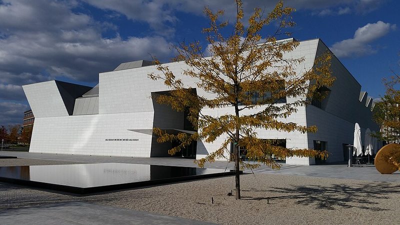
North York does not function as a tourist destination in the conventional sense. The district offers limited attractions compared to central Toronto and lacks the density of museums, galleries, or historic sites that draw travellers. Don Mills holds architectural and planning interest for those studying postwar suburban development, but the community itself is residential. Edwards Gardens provides green space within Toronto's northern reaches. The practical answer is that North York serves visitors with specific purposes—connecting through the region, visiting residents, or accessing northern Toronto services—rather than offering a compelling reason for a dedicated visit.
Where to Stay in North York?
Accommodation in North York serves business travellers and visitors seeking positioning in northern Toronto. The Yonge Street corridor, particularly near North York Centre and Sheppard subway stations, provides transit access and proximity to commercial services. The area functions more as a commuter zone than a tourist base. Travellers focused on Toronto's downtown attractions will find central locations more convenient; those requiring access to York Region or points north may find North York's position practical for those specific purposes.
How Many Days Do You Need?
North York does not require dedicated time on a Toronto itinerary unless visiting residents or conducting specific business in the district. A half-day visit to Edwards Gardens or an architectural tour of Don Mills could suit travellers with specialised interests in planning history or urban development. Most travellers will encounter North York as a transit corridor or residential district rather than a destination requiring overnight stays or multiple days.
Is North York Safe for Visitors?
Canada operates under normal travel precautions according to both UK and US travel advisories. Neither the UK Foreign Office nor the US State Department has issued specific warnings for North York or the Toronto region. The district functions as an established residential and commercial area within Toronto. Standard urban precautions apply. Travellers should consult current official guidance from their home country's foreign office before departure.
Getting Around
The Toronto Transit Commission's Yonge–University subway line runs through North York with stations at Sheppard, North York Centre, Finch, and several others providing north-south access. Bus routes connect to residential neighbourhoods east and west of Yonge Street. Highway 401 provides regional automobile access, though traffic congestion is common during peak periods. The district's suburban layout means many areas are more easily accessed by car than public transit, though the Yonge corridor itself maintains good transit service.
For current transit schedules, fares, and route maps, travellers should consult the Toronto Transit Commission website or local transport information.