What South Boston is known for
Note: South Boston is a neighborhood within the city of Boston, not a separate municipality. The population figure of 571,281 reflects Boston as a whole; South Boston's neighborhood population is substantially smaller.
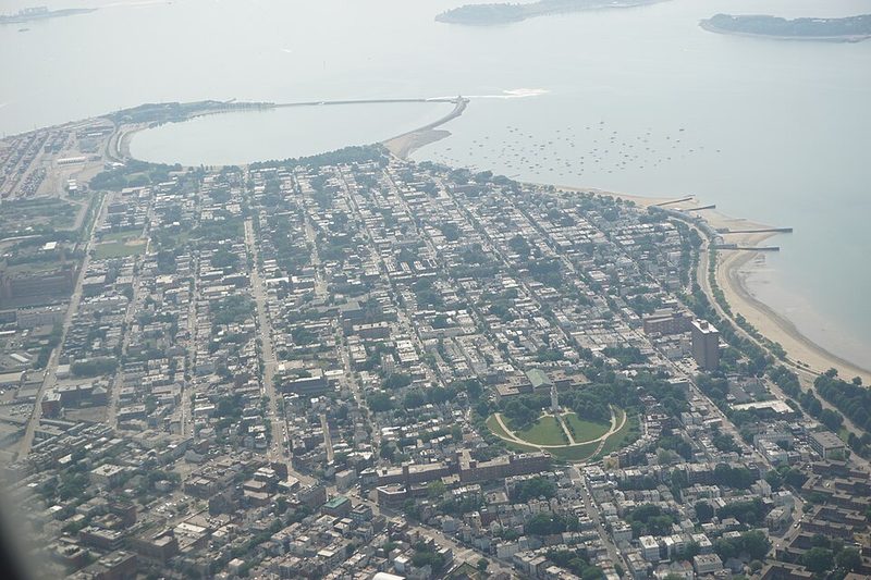
South Boston sits on a peninsula jutting into Dorchester Bay, a densely populated Boston neighborhood where brick rowhouses meet waterfront development and working-class heritage collides with recent demographic change. The district has spent two centuries reinventing itself—from farmland to Irish Catholic stronghold to the diverse, rapidly changing neighborhood visible today.
Geography and First Impressions
The neighborhood occupies land south and east of the Fort Point Channel, bordered by water on multiple sides. This geography gives South Boston a distinct physical separation from central Boston, which historically contributed to its strong sense of community identity. The elevation is modest—approximately 20 metres above sea level—and the proximity to Dorchester Bay shapes the district's character and its historical relationship to maritime work and waterfront commerce.
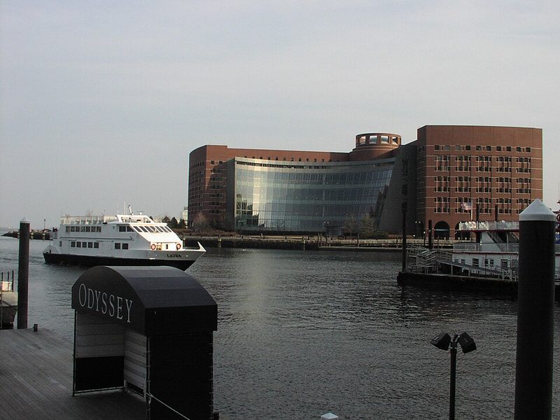
Visitors arriving by public transport will notice the residential density immediately. Blocks of three- and four-storey rowhouses dominate, many with the distinctive architectural style associated with early twentieth-century construction. The streetscape feels lived-in and working-class in character, though that character is visibly shifting. New development, particularly in waterfront areas, has introduced modern apartment buildings and renovated spaces alongside older housing stock. Streets are often narrow and follow patterns established before modern planning conventions.
Historical Development
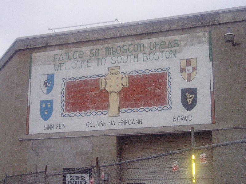
South Boston was annexed to the city of Boston in 1804. Before annexation, the area functioned primarily as farmland. The major transformation came with Irish Catholic immigration in the nineteenth and twentieth centuries, which gave the neighborhood its most durable identity. For most of the twentieth century, South Boston was understood as a working-class Irish American enclave with dense social and religious networks centred on the Catholic Church, local schools, and family ties.
That identity was challenged and tested during the 1974 desegregation busing crisis, when a federal court ordered busing of students between South Boston and predominantly Black neighborhoods. The conflict, particularly centred on South Boston High School, resulted in violence and national attention. In September 1974, nine Black students were injured when protestors threw rocks at school buses. Judge Arthur Garrity issued orders prohibiting groups of three or more persons from gathering within 100 yards of the school. The crisis continued through the fall of 1976 and remains a significant chapter in the neighborhood's history.
Contemporary Character
By the early twenty-first century, the character of South Boston began to change again. Young professionals, particularly millennials, have increasingly moved into the neighborhood, drawn by its relative proximity to downtown Boston and waterfront development. This transformation is still underway and remains a topic in local conversation and city planning. The demographic shift has driven rising housing costs and altered the neighborhood's composition in ways that remain actively negotiated in local life.
The neighborhood functions as a residential district for working and professional classes. For much of its modern history, local employment was rooted in manual and service work. The waterfront and port facilities nearby have historically provided work, as have transportation, construction, and small business. Many recent arrivals work in downtown offices, healthcare, education, or technology-related roles elsewhere in the region. Coffee shops, gyms, and small retail spaces have opened to serve this population, though longtime institutions—bars, bakeries, and religious establishments rooted in the Irish community—remain visible alongside newer businesses.
Waterfront and Beaches
South Boston's waterfront includes a three-mile stretch of parkland along the Dorchester Bay shoreline. Castle Island, a 22-acre former island and military fortification site, juts into Boston Harbor and has been the location of a fort since the 1630s. The current Fort Independence was completed in 1851 using over 172,687 linear feet of hammered granite. The site has been occupied by various fortifications since 1634, when Governor John Winthrop ordered the first fort's construction. During the Revolutionary War, it was occupied by British officials until the Siege of Boston in 1775.
Pleasure Bay, M Street Beach, and Carson Beach form the continuous beach area along the South Boston shoreline. Carson Beach is the largest, stretching from K Street to the State Police Barracks. These beaches are maintained by the state's Department of Conservation and Recreation and provide public waterfront access. The beaches and Castle Island attract walkers, runners, and visitors year-round.
Getting There and Around
South Boston is accessible by MBTA bus routes connecting it to downtown Boston and surrounding neighborhoods. The Red Line rapid transit system serves Broadway station and Andrew station, both providing access to South Boston. For those driving, access is via city streets; parking availability should be checked locally. Taxis and ride-sharing services operate throughout Boston and reach South Boston addresses. The street layout reflects pre-automobile development, which makes the neighborhood pedestrian-scaled but occasionally confusing to navigate without a map.
Practical Considerations
South Boston operates under standard US urban conditions. The UK Foreign and Commonwealth Office maintains normal precautions travel advice for the United States generally, with no specific warnings for Boston or Massachusetts. Standard city practices apply—be aware of surroundings, use well-lit streets at night, and keep valuables secure. Spring and autumn offer pleasant weather for walking; winters are cold and sometimes snowy, with temperatures regularly below freezing.
The neighborhood is walkable in parts, though the street layout can be confusing without directions. A map or phone navigation is useful. Visitors should note that South Boston is a residential neighborhood rather than a tourist district; attractions are dispersed rather than concentrated in a single area.
Castle Island and Fort Independence
Castle Island, a 22-acre park at South Boston's southern tip, holds Fort Independence—the oldest continually fortified site in British North America. The current five-bastioned granite fort dates to 1851, though fortifications have occupied this harbour position since the 1630s. During the Revolutionary War, British forces held the fort until the 1775 Siege of Boston, and it later served as a Civil War recruitment headquarters.
Today the site functions as a public waterfront park managed by the Massachusetts Department of Conservation and Recreation. Fort Independence offers seasonal ranger-led tours through its thick granite walls and gun emplacements. The causeway connecting Castle Island to the mainland encloses Pleasure Bay and forms part of a popular 2.5-mile paved walking loop used heavily by local residents. Sullivan's, a seasonal walk-up seafood stand operating since 1951, sits near the parking area.
The site is accessible by car via Day Boulevard or by MBTA bus routes serving South Boston. Parking fills quickly on warm weekends. The park itself is free and open year-round, though fort tours run only from late spring through early autumn. The waterfront location means consistent wind and cooler temperatures than inland Boston.
Sources: Castle Island / Fort Independence - The Cultural Landscape Foundation • Fort Independence - Castle William - National Park Service • Fort Independence - Massachusetts Historical Society
South Boston St Patrick's Day Parade
The South Boston St Patrick's Day Parade, held annually on or near 17 March, is the oldest such celebration in North America. Boston's Irish community first gathered on this date in 1737, and the organised parade tradition dates to 1901. The event officially commemorates both St Patrick's Day and Evacuation Day—the 17 March 1776 British withdrawal from Boston—giving it dual cultural and civic significance.
The parade attracts large crowds, with MBTA estimates reaching one million attendees. The route runs through South Boston along Broadway and East Broadway, passing through residential streets that historically formed the heart of Boston's Irish Catholic community. Organised by the South Boston Allied War Veterans Council since 1901 and funded by community donations, the parade includes marching bands, military units, cultural organisations, and political figures.
Visitors should use public transport—the Red Line's Broadway and Andrew stations are within walking distance—as driving is impractical due to street closures. Weather on 17 March is unpredictable, ranging from freezing to mild, with possible rain or snow. The parade represents South Boston's Irish American institutional memory and remains a significant annual event even as the neighbourhood diversifies.
Read the full South Boston St Patrick's Day Parade guide
Sources: South Boston St. Patrick's Day / Evacuation Day Parade - Official Site • History - South Boston St. Patrick's Day Parade • Boston's St Patrick's Day Parade Route - Boston Discovery Guide • When was the first St. Patrick's Day parade in Boston? - Patriot Ledger
1974 Busing Crisis
The 1974 busing crisis in Boston, centred on South Boston High School, was one of the most violent episodes in American school desegregation history. In June 1974, Judge W. Arthur Garrity issued the Morgan v. Hennigan ruling, mandating desegregation by busing approximately 20,000 white and Black students across Boston. South Boston High was paired with predominantly Black Roxbury High, bringing the court order into direct conflict with the neighbourhood's Irish Catholic community.
When schools opened on 12 September 1974, protestors threw rocks at buses carrying Black students, injuring nine on the first day. Violence continued through 1975, and by September of that year, Judge Garrity prohibited groups of three or more from gathering within 100 yards of the school. White flight accelerated, draining resources from Boston Public Schools, and South Boston High never recovered its pre-crisis enrolment or reputation.
No dedicated museums or monuments in South Boston commemorate the crisis. Archival resources at the Boston Public Library hold newspaper coverage, photographs, and school committee records. The crisis remains essential context for understanding South Boston's identity and its dramatic transformation since the 1970s.
Sources: Boston desegregation busing crisis - Wikipedia • Busing Crisis - Boston Public Schools Historical Research - Boston Public Library • A walking tour of Boston's busing history - GBH • Busing, Segregation, and Education Reform in Boston - Poverty USA
South Boston Beaches
South Boston's beaches form a three-mile stretch along Dorchester Bay, managed by the Massachusetts Department of Conservation and Recreation. Carson Beach, the largest, runs from K Street to the State Police Barracks with designated swimming areas, lifeguards during summer months (typically late June to early September), and bathhouses. M Street Beach is smaller and more neighbourhood-oriented, home to the L Street Brownies swimming club and their traditional New Year's Day cold-water swims.
Pleasure Bay, an artificial harbour enclosed by the Castle Island causeway, features a popular 2.5-mile paved walking loop connecting to both Castle Island and M Street Beach. The path is flat, accessible, and heavily used by joggers, walkers, and cyclists year-round. Water temperatures remain cold even in summer (15–20°C in July and August), and wind is near-constant along the shoreline.
The beaches are accessible by car via Day Boulevard, though parking fills quickly on warm days. MBTA bus routes provide more reliable access. These are utilitarian public spaces serving the local neighbourhood rather than tourist destinations, with minimal commercial amenities beyond Sullivan's seasonal stand at Castle Island. Visitors should expect neighbourhood crowds, bring layers for wind, and check DCR for current lifeguard schedules.
Sources: Carson Beach, South Boston - Wikipedia • South Boston Beaches, a Photographic Study - Massachusetts Historical Society