October in Cleveland carries a particular quality of light. The sky over Lake Erie goes pewter in the mornings, and by midday the city looks as though someone has cleaned the glass. It is a good month to walk.
Start on Public Square. The Soldiers and Sailors Monument stands near the centre — a substantial Victorian column and base completed in 1894 to commemorate Cuyahoga County's Civil War dead. The encyclopedia of Cleveland's own history records that the 8th Ohio showed exceptional courage at Gettysburg, and that the 23rd Ohio counted two future US presidents among its ranks. The monument does not announce any of this loudly; it simply stands there, stone and bronze, while buses circle the square and office workers cross it on their lunch break.
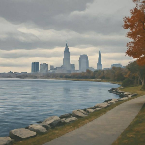
From the square, the city opens in layers. Walk north toward the Mall — the formal civic green that stretches from the core toward the lakefront. The buildings lining it were built when Cleveland believed, with some justification, that it would be one of the great American cities indefinitely. The Cleveland Browns Helmet water tower and the Terminal Tower's silhouette both appear in different directions. Cleveland Magazine has documented twenty landmarks it considers definitional to the city; the Mall's axis connects several of them.
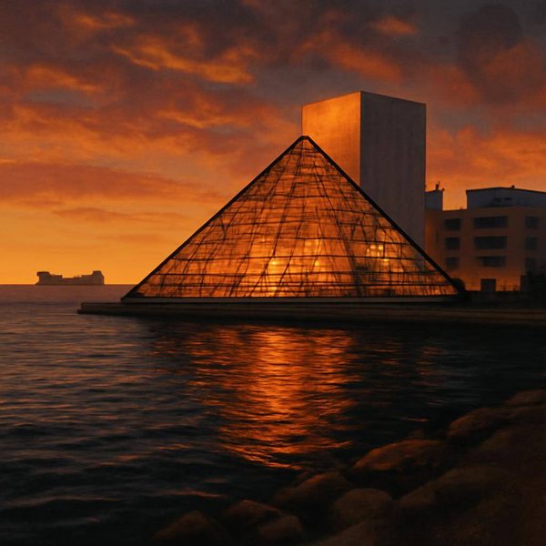
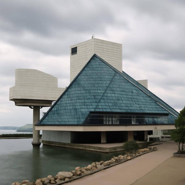
Keep walking north. The lakefront arrives without ceremony: a flat grey expanse of Erie, and then the glass pyramid of the Rock and Roll Hall of Fame on the water's edge. The building was designed by I. M. Pei and opened in 1995, and it is easy enough to be dismissive of an institution that asks you to take seriously the idea that rock and roll needs a hall of fame. But stand outside it in October, with the lake behind you, and it makes a certain kind of sense. Cleveland's claim was built on radio — specifically on the DJs and stations in this city who pushed the music onto the airwaves when other cities were not sure what to do with it. The Hall is a monument to that, in the way the Soldiers and Sailors Monument is a monument to something else entirely.
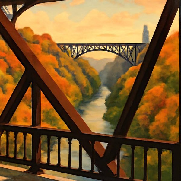
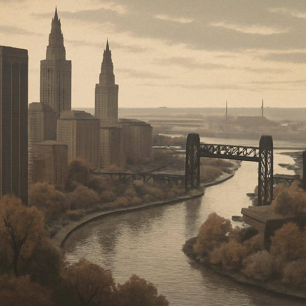
Now walk back toward the river. The Cuyahoga cuts through the city in a gorge that the bridges span with quiet industrial confidence. In June 1969, the river caught fire — not the first time it had done so historically, but the time that caught the attention of the national press, the time that landed in magazines and drove arguments in Congress that led, three years later, to the Clean Water Act. The National Park Service now designates it a National Heritage River. The NASA Glenn Research Center, based in Cleveland, has published the history of how it got that way and how it recovered.
In 1969, months after the fire, the arguments had not yet resolved. The city was loud with competing ideas about what Cleveland was and what it should become. Walk down to the Flats, where the lower Cuyahoga runs between the old industrial banks, and the argument is still legible in the landscape: warehouse walls, a surviving bridge truss, a stretch of water that is clean enough now to support fish. The recovery was not fast, and it was not finished in any single dramatic moment. It happened in the ordinary accumulation of legislation, maintenance and changed behaviour over decades.
By mid-afternoon, the light over the lake has shifted again. Head back through the East Fourth Street Historic District, where the restored commercial buildings from Cleveland's late nineteenth-century peak now hold restaurants and bars. It is the kind of street that works better in the evening, but in October afternoon light the carved stone facades are worth looking at slowly. The city at its industrial height built for permanence, for the assumption that it would still be here and still matter a century later. That assumption proved more complicated than expected. But the buildings are still here, and so is the river, and so, for what it is worth, is the Hall of Fame on the lakefront, its glass catching the last of the afternoon light off Erie.
Practical note: Public Square, the Mall, East Fourth Street and the Rock and Roll Hall of Fame lakefront are all within reasonable walking distance of each other in central Cleveland. The GCRTA Red Line connects the airport to downtown and onward to University Circle; current schedules are at riderta.com. October is a quieter visiting period than summer; lake-effect weather can arrive quickly, so carry a layer.
Frequently Asked Questions
What practical route does this Cleveland story follow?
It follows source-backed places and route anchors from the guide, giving orientation and atmosphere while leaving live transport and opening details to the linked sources.
Which live details should I check before using this Cleveland route?
Check current transport, access, opening and weather information from the linked official or operator sources before travelling.
What does this route help visitors understand about Cleveland?
It turns source-backed places, route anchors and local context into a readable visitor route, so the story supports the main guide rather than replacing practical planning.
This is a fictional visitor story generated from source-backed place facts, image evidence and visitor-feel signals. It is not a first-hand WorldTownGuide visit. Named places, routes and historical references are source-backed; the visitor character and narrative events are invented.
Sources: The Cuyahoga - a National Heritage River - National Park Service • Rock and Roll Hall of Fame and Museum - Pei Cobb Freed • Cleveland Fights the Civil War - The Cleveland Civil War Roundtable • Iconic Cleveland - 20 Landmarks That Define Our City - Cleveland Magazine • GCRTA schedules - riderta.com via Transit App