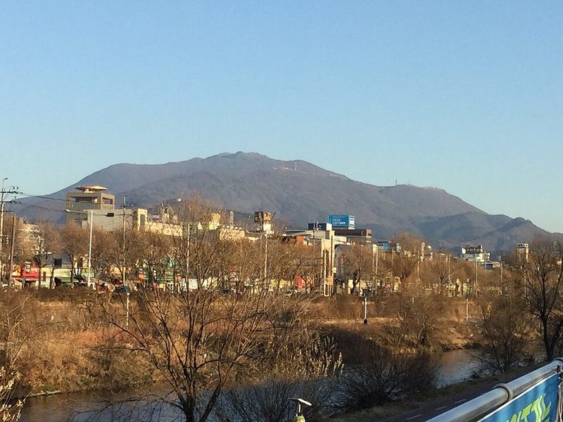
Mudeungsan National Park rises immediately east of Gwangju, a mountain of columnar rock formations, Buddhist temples, and hiking trails that has shaped the city's horizon and identity for centuries. Designated as South Korea's 21st national park, Mudeungsan (the name means "Peerless Mountain") is celebrated both for its geological significance and its role in Korean mountain culture. The park attracts hikers of varying abilities, with routes ranging from gradual slopes accessible to most walkers to challenging ridge trails requiring stamina and experience.
Geological Features
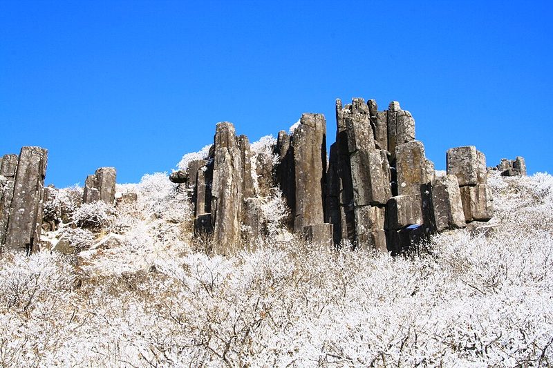
Mudeungsan's defining characteristic is its spectacular columnar jointing—vast formations of pentagonal and hexagonal rock columns formed during the late Cretaceous Period approximately 87 million years ago. When volcanic eruptions expelled ash and pyroclastic material, these deposits accumulated and hardened into volcanic tuff. As the material cooled and contracted, it fractured into the distinctive columnar structures visible today across the mountain's ridges and peaks.
The most prominent formations include Ipseokdae (Standing Rock Platform), Seoseokdae, and Gwangseokdae—colonnades reaching 30 to 40 metres in height with individual columns up to 7 metres in diameter, among the largest columnar joint formations in the world. These geological features earned Mudeungsan designation as a UNESCO Global Geopark, with trails specifically designed to showcase the columnar joints along routes between the peaks. The Mudeungsan Tuff that forms these columns contains quartz-bearing crystals, occasionally visible as hyaline inclusions in the rock.
Temples and Cultural Sites
Three significant Buddhist temples occupy the mountain's base and lower slopes: Jeungsimsa, Wonhyosa, and Yakshasa (also rendered Yaksasa). Jeungsimsa Temple sits at the base of the main hiking routes and serves as a practical starting point for many walkers, with parking facilities and bus access via route 1187. Wonhyosa Temple, located on the Gwangju side of the mountain, marks another trailhead connecting to the Gyeongsang-ri Information Center in neighbouring Damyang. These temples maintain active Buddhist practice while welcoming visitors, and hikers typically encounter monks, temple structures, and devotional sites along the lower sections of trails.
Hiking Routes and Trails
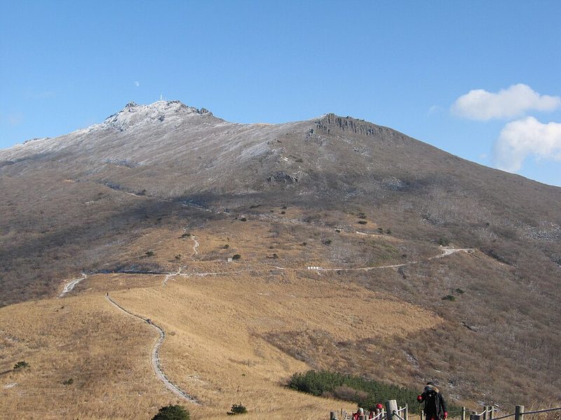
The park offers multiple trails, with the main routes considered moderate to challenging depending on the specific path chosen. The most popular route from Wonhyosa Temple to the Seoseokdae peak via the columnar joints covers approximately 7.4 miles (12 kilometres) with an elevation gain of over 1,000 metres, typically requiring 5 to 6.5 hours to complete. Trail guides describe this as a challenging route suited to experienced hikers, though the terrain itself—a mix of established paths, rocky steps, and ridge sections—is well-maintained.
Alternative routes offer less strenuous options, including forestry roads and gradual slopes that make the lower elevations accessible to casual walkers. Some hikers report that these easier approaches, while longer in distance, provide quicker overall times due to less technical terrain, though they offer fewer dramatic viewpoints. The ridge trails between the columnar formations and the northern peak (Buk-bong) pass through areas of significant weathering and secondary jointing, where the geological processes remain visible and active.
Trail conditions vary seasonally. The mountain is noted for its appearance across all four seasons—green and forested in summer, colourful in autumn, and snow-covered in winter, when conditions become more challenging. Spring and autumn are generally preferred by hikers for moderate temperatures and visibility.
Practical Information
Access to Mudeungsan National Park from central Gwangju is straightforward via public transport. Bus numbers 1187 and 1187-1 connect the city to Wonhyosa Temple, a primary trailhead. The journey takes visitors through areas where shops and cafes incorporate the bus number into their names, a local quirk reflecting the route's importance. Car access is available, with parking facilities at the temple and park entrance points, including electric vehicle charging stations and standard amenities.
The park operates information centres providing maps, trail guidance, and current conditions. Hikers should carry water and appropriate footwear, particularly for the upper ridge sections where rocky terrain and columnar formations dominate. Mobile coverage exists on main trails but can be unreliable on more remote sections. No entrance fee information is available from current sources; visitors should confirm current policies locally.
The Chunseol Tea Plantation, located on the mountain's slopes, produces tea for which the area is locally known, though visitor access and purchasing information should be confirmed on-site. The park's designation as a UNESCO Global Geopark has resulted in interpretive signage explaining the geological features in Korean and English along major trails.
Sources: Mudeungsan National Park - VISITKOREA • Mudeungsan UNESCO Global Geopark • Genesis of columnar joints - Earth, Planets and Space