
Getting Around Istanbul Without a Car
Istanbul has one of the most extensive public transport networks of any city in the region. For visitors, the practical backbone is a combination of tram, metro and ferry, all accessible with a single İstanbulkart contactless card. The card can be loaded with credit and used across metro, tram, bus and ferry services — it is the standard payment method for public transport in Istanbul and is more convenient than buying individual tickets or tokens for each journey.
Tram
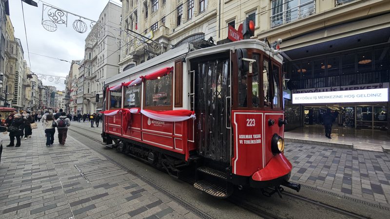
The T1 tram line (Bağcılar to Kabataş) is the most visitor-relevant route on the European side. It runs through Zeytinburnu, Sultanahmet, Eminönü and Karaköy, covering the historical peninsula and the Galata Bridge area. The T2 line (Taksim–Tünel) is a short nostalgic tram along İstiklal Avenue. The T3 line runs between Kadıköy and Moda on the Asian side. T4 runs from Topkapı to Mescid-i Selam; T5 connects Cibali and Alibeyköy.
Metro
The M2 metro line runs from Yenikapı north through Aksaray and Taksim Square to Hacıosman, providing a fast spine through the European side. Zeytinburnu is a key interchange between the M1 metro and the T1 tram. The metro network continues to expand; the official Metro Istanbul site carries current route maps and a journey planner.
Ferry
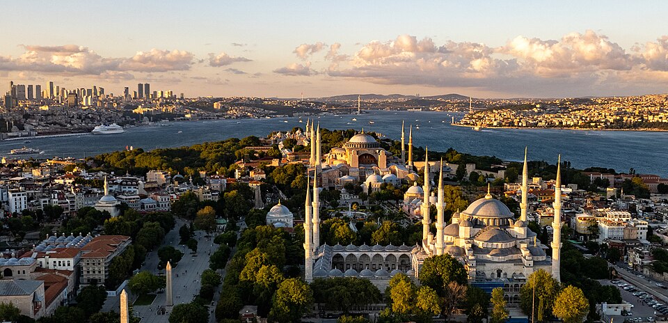
Ferries are a practical and frequently used way to cross between the European and Asian shores. Regular services connect Eminönü and Karaköy on the European side with Kadıköy and other Asian-side piers. The crossing itself gives a useful perspective on the city's geography. Ferries are run as part of the broader public transport system and accept the İstanbulkart.
Bus
The İETT bus network covers nearly 500 lines, around 3,000 buses and approximately 8,000 stops across the city. It is the cheapest option but can be complex to navigate for first-time visitors. Bus 22, 25E and 40 serve Ortaköy. The official İETT site and apps provide route-finding tools.
Practical Notes
Taxis are available across the city; ride-sharing apps also operate. Many heritage-district journeys are walkable, but the overall scale of Istanbul means planning matters. Traffic can make road-based journeys slow at peak hours — the tram and metro avoid this. For timetables and current fares, use Metro Istanbul and İETT directly. Third-party guides such as Istanbul Tourist Information and Too Istanbul offer useful tourist-oriented summaries.
Frequently Asked Questions
Which transport sources should I check for İstanbul?
Use Public Transport in Istanbul: Metro, Tram, Ferry, Prices and Tips for Tourists - Istanbul, Our guide to public transportation in Istanbul - Too Istanbul, Istanbul Public Transportation: A Survival Guide for Travelers - Nomadic Niko, Metro Istanbul - Fares and Ticket Prices for current routes, fares and operating changes. WorldTownGuide gives source-backed orientation, not live timetable rows.
Can I use this page as a live timetable for İstanbul?
No. Transport routes, seasonal frequencies, engineering works and ferry operations can change. Use the linked operator or timetable sources before travelling.
Sources: Public Transport in Istanbul: Metro, Tram, Ferry, Prices and Tips for Tourists - Istanbul • Our guide to public transportation in Istanbul - Too Istanbul • Istanbul Public Transportation: A Survival Guide for Travelers - Nomadic Niko • Metro Istanbul - Fares and Ticket Prices • IETT - Istanbul Bus and Tram Operator • Istanbul Airports, Bus, Tram, Train, Taxi, Metro, Ferry and Ship - Turkey Travel Planner