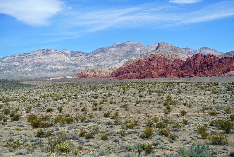
Red Rock Canyon National Conservation Area sits approximately 24 kilometers west of Las Vegas, where the Mojave Desert meets the eastern escarpment of the Spring Mountains. The conservation area protects dramatic red sandstone formations, desert ecology, and archaeological sites across approximately 195,000 acres managed by the Bureau of Land Management. The accessibility from Las Vegas makes it the primary natural landscape destination for visitors seeking desert terrain and hiking beyond the urban valley.
The Scenic Drive
The main visitor route is a one-way 13-mile scenic drive that loops through the conservation area, providing access to overlooks, trailheads, and geological features. The paved road begins at the visitor center and returns visitors to the same point, with designated pullouts for viewing and photography. The drive itself takes approximately 30-45 minutes without stops, but most visitors spend several hours exploring trails and formations along the route.
Since 2021, the Bureau of Land Management has implemented a timed entry reservation system for the scenic drive during peak periods. Visitors must book entry times in advance through the Recreation.gov website, particularly during spring and autumn months when temperatures are moderate and visitation peaks. This system manages vehicle volume to reduce congestion and protect the landscape. Walk-in, bicycle, and organized tour access operate under different rules—current entry requirements should be verified before visiting.
Geology and Landscape
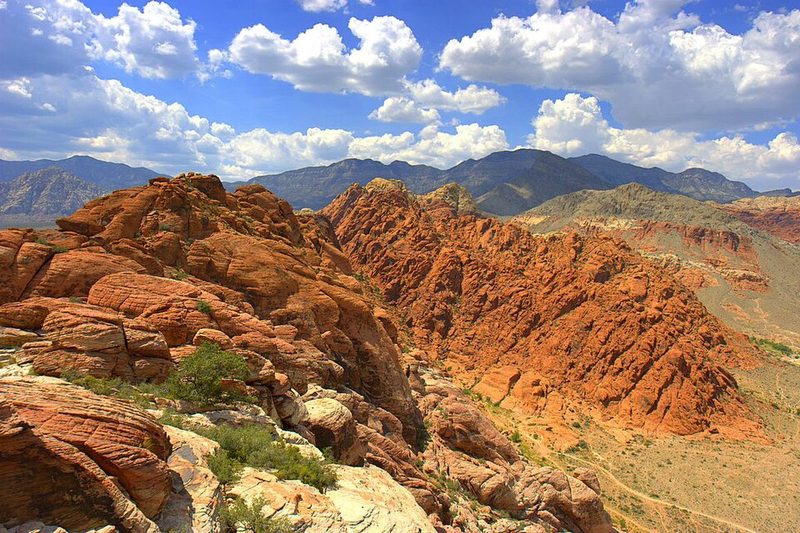
The red and orange sandstone formations that give the area its name formed from ancient sand dunes, later uplifted and exposed through erosion. The Keystone Thrust Fault, visible at several points along the scenic drive, represents a major geological feature where older gray limestone sits above younger red sandstone—a reversal of normal layering caused by tectonic movement. The contrast between the dark desert varnish on some rock faces and the bright red sandstone creates the distinctive visual character visitors notice immediately.
Elevation within the conservation area ranges from approximately 3,600 feet in the valley to over 7,000 feet in the higher Spring Mountain terrain. This elevation gradient creates varied ecosystems: creosote and Joshua tree desert at lower elevations transitioning to pinyon-juniper woodland higher up. The landscape is arid, with seasonal water sources supporting concentrated plant and animal life in specific drainages.
Hiking and Recreation
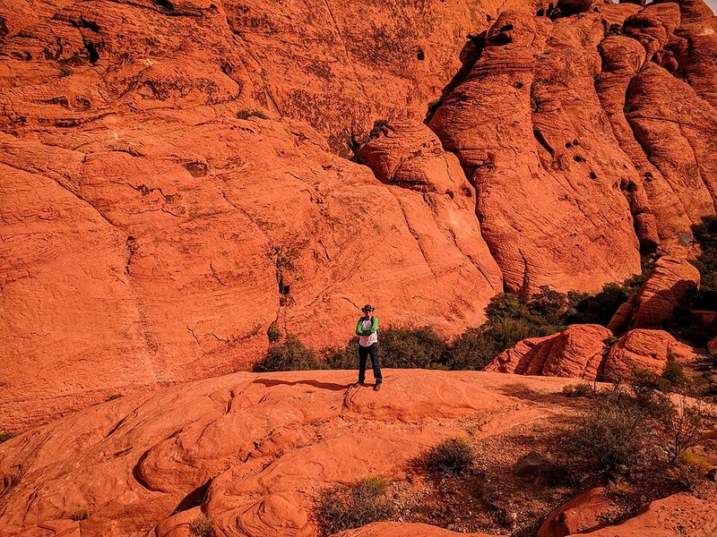
The conservation area contains more than 30 miles of maintained hiking trails ranging from short nature walks to strenuous full-day routes. Popular shorter hikes include Calico Tanks, a moderately strenuous trail involving rock scrambling that leads to natural water-holding depressions and provides views over the Las Vegas valley. The trail sees high use and accommodates a range of ages and fitness levels, though the rock scrambling sections require attention.
Longer routes include the trail to Bridge Mountain, described as a bucket-list desert mountaineering objective requiring significant elevation gain and navigation through pinyon-juniper forest and exposed slickrock. Trail conditions, seasonal water availability, and current closures should be verified with the visitor center or BLM before attempting backcountry routes.
Rock climbing is another major activity. Red Rock Canyon hosts hundreds of established climbing routes on sandstone and limestone faces, drawing climbers internationally. The area's climbing culture predates its designation as a national conservation area, and route development continues under BLM management guidelines.
Visitor Center and Facilities
The Red Rock Canyon Visitor Center serves as the entry point for the scenic drive and provides interpretation about geology, ecology, and cultural history. Indoor and outdoor exhibits explain the area's formation and the human history of the region, including evidence of prehistoric habitation. The center offers maps, current trail conditions, and ranger assistance. Camping is available at a designated campground within the conservation area, though sites require advance reservation during peak seasons.
Planning a Visit from Las Vegas
The 24-kilometer distance from Las Vegas makes Red Rock Canyon accessible as a half-day or full-day excursion. Visitors should plan for the drive time from the Strip or downtown (typically 30-45 minutes depending on traffic), plus several hours within the conservation area itself. The desert environment requires preparation: abundant water, sun protection, appropriate footwear for rocky terrain, and awareness of temperature extremes. Summer temperatures regularly exceed 38°C (100°F), making early morning visits essential during June through September. Spring (March-May) and autumn (October-November) offer more moderate conditions, which drives the peak visitation that necessitates the timed entry system.
No food or fuel services exist within the conservation area. Visitors should bring supplies and ensure vehicles are in good condition before entering. Mobile phone coverage is limited in portions of the scenic drive and backcountry areas. The conservation area charges an entrance fee; current rates and payment methods should be verified in advance.
Sources: Red Rock Canyon National Conservation Area - BLM • Red Rock Canyon - Wikipedia • Red Rock Canyon Official Website • Recreation.gov - Red Rock Scenic Drive Timed Entry