
The Mississippi River at New Orleans
The Mississippi River defines New Orleans more than any other physical feature. The city occupies the inside of a pronounced bend — the crescent that gives the Crescent City its nickname — with the river curving around the southern and eastern edges of the older neighbourhoods. The French Quarter and the Central Business District both front onto the river, and the riverfront is accessible to visitors on foot along the Moonwalk promenade above the levee.
The river here is a working waterway carrying substantial commercial freight. New Orleans sits at the lower end of one of the world's great river systems, and the port infrastructure — stretching along both banks — reflects that role. Visitors will see container ships, tankers and barges moving through at close range, which gives the river a different character from a recreational waterfront.
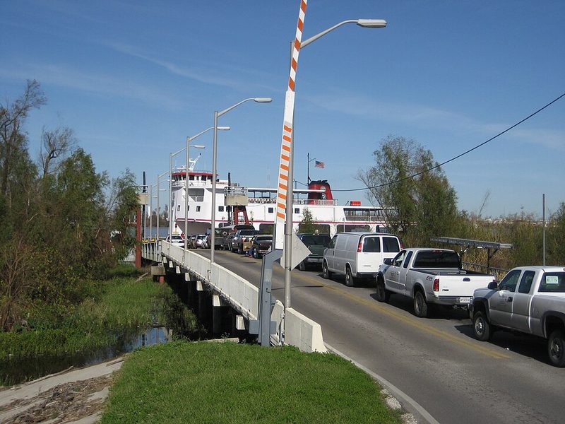
The Algiers Ferry is the most practical way for visitors to experience the river directly. The ferry crosses between the Canal Street terminal on the East Bank and the Algiers Point terminal on the West Bank. It operates as part of the Regional Transit Authority network and accepts the Jazzy Pass; the crossing takes only a few minutes but gives a clear view of the city skyline from the water and provides access to the Algiers neighbourhood, a quieter residential area with its own historic streetscape. Visitors should check current NORTA schedules before travelling, as operating hours and service notices can change.
Passenger cruise boats and steamboat excursions also operate on the river from the riverfront near Jackson Square, offering a longer experience of the waterway. These are separate from the ferry: the ferry is a transit service, while cruise/steamboat services are ticketed visitor experiences with their own schedules and fares. Visitors should verify current operators and departure times locally.
The river's geography also explains much of New Orleans' vulnerability to flooding. The city sits largely below river level, protected by levees, and the catastrophic flooding following Hurricane Katrina in 2005 was shaped by the river and lake system surrounding the city. That history is part of any honest account of what New Orleans is.
Sources: Huey P. Long Bridge (Jefferson Parish) - Wikipedia • Best Day Trips from New Orleans Under Three Hours - Travel on the Reg • Navigating New Orleans - neworleans.com