What Ottawa is known for
Canada's capital sits at the meeting point of three rivers—the Ottawa, Rideau, and Gatineau—in a landscape shaped by water and timber. With over a million residents, Ottawa combines parliamentary government, a substantial technology sector, and several national museums into a city that functions as both administrative capital and regional centre. The Rideau Canal, a UNESCO World Heritage Site constructed in the 1820s, runs through the city centre and converts each winter into what is promoted as the world's largest skating rink.
Geography and First Impressions
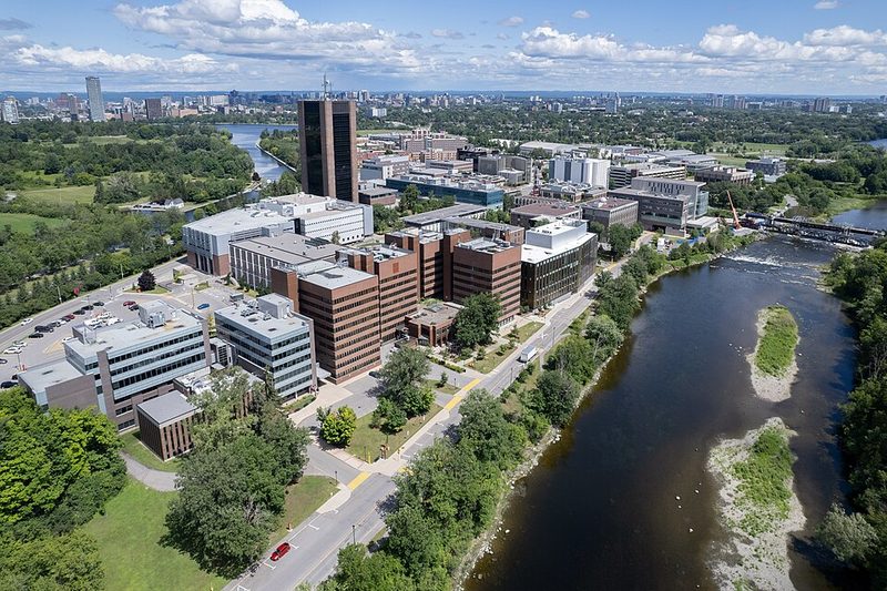
Ottawa occupies relatively flat terrain in southern Ontario at the confluence of the Ottawa and Rideau rivers, approximately 70 metres above sea level. The Ottawa River forms the provincial boundary with Quebec, and Gatineau sits directly across the water, making the National Capital Region a bilingual metropolitan area split between two provinces. Water features prominently throughout the city—not as distant backdrop but as corridors that shape transport routes, recreational space, and the way neighbourhoods connect to one another.
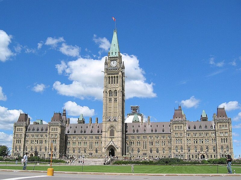
The architectural character mixes Victorian-era stone buildings with modern government structures. Parliament Hill, with its Gothic Revival parliament buildings overlooking the Ottawa River, forms the symbolic centre, though the city extends far beyond that landmark into residential and commercial districts across both riverbanks.
Historical Context
The Ottawa area lies within traditional Anishinà beg Algonquin territory. Archaeological evidence places human activity here to approximately 6,500 BCE, with the Ottawa River serving as a crucial trade route for thousands of years. The river's name derives from an Algonquin word meaning "to trade," reflecting the commercial activity that defined the region long before European contact.
European explorers including Étienne Brûlé (1610) and Samuel de Champlain (1613) navigated the Ottawa River in the early 1600s, but permanent European settlement developed only in the early 1800s when Irish, British, French, and Scottish settlers established a timber trade. By the 1820s, a settlement called Bytown emerged around lumber operations. The Rideau Canal, constructed beginning in 1826 as a military defence route and transport corridor connecting Ottawa to Kingston and the Great Lakes system, accelerated the settlement's growth and infrastructure development.
Bytown was renamed Ottawa in 1855. Queen Victoria's selection of Ottawa as capital of the newly formed Dominion of Canada in the 1860s reflected a preference for a location between English-speaking and French-speaking populations. That decision fundamentally reshaped the city's economy, shifting investment and employment from timber toward federal institutions.
Economy and Daily Life
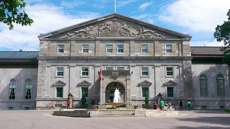
The public sector remains Ottawa's largest employer. The federal government's presence drives much of the local economy, though the city has developed a substantial technology sector—significant enough to earn the nickname "Silicon Valley North" in reference to software firms, research institutions, and a workforce drawn partly from local universities. Tourism sustains considerable activity, with Parliament Hill, Rideau Hall (the Governor-General's residence), and several national museums drawing visitors year-round.
Professional sports include the Ottawa Redblacks (Canadian Football League) and the Ottawa 67's (Ontario Hockey League), with games at Lansdowne Park serving as community gathering points. The city's bilingual character—with substantial English and French populations—shapes street signage, government services, and cultural programming, reflecting both national policy and Ottawa's position adjacent to Quebec.
What Visitors Encounter
The Rideau Canal forms one of the most visible features for visitors. The canal path is accessible and connects different parts of the city on foot or bicycle. Each winter, a section of the canal between Carleton University and Confederation Park freezes and is maintained as the Rideau Canal Skateway, which opened in January 1971 and draws both residents and visitors during colder months. Parliament Hill offers views across the Ottawa River toward Gatineau, making the interprovincial boundary and regional geography visible from the ceremonial centre.
Seven national museums operate in the Ottawa-Gatineau area, including the Canadian Museum of History (across the river in Gatineau, noted for the world's largest indoor collection of totem poles) and the National Gallery of Canada (near ByWard Market). The National Gallery features the sculpture Maman by Louise Bourgeois—a large spider sculpture—at its entrance, and houses Indigenous and Canadian galleries alongside rotating exhibitions.
Neighbourhoods and Districts
The ByWard Market, the city's oldest and most tourist-oriented district, sits between the Ottawa River and the Rideau Canal near Parliament Hill. The area contains restaurants, shops, and the historic public market building. The Glebe, a residential neighbourhood along the canal south of downtown, offers quieter streets with local shops and cafés. Westboro and Hintonburg, both dating to the 19th century, lie west of downtown and have developed reputations for independent restaurants and neighbourhood amenities. These areas are accessible by public transport and provide alternatives to staying directly in the downtown core.
Seasonal Events
Ottawa hosts more than 60 festivals annually. Winterlude, a nearly 40-year-old winter festival established in 1979, runs in January and February and centres on winter activities including the canal skateway, ice sculptures, and outdoor events. The Canadian Tulip Festival, held in spring, dates to a tradition begun after the Second World War when the Netherlands gifted tulip bulbs to Canada. RBC Bluesfest, a ticketed music festival, brings national and international acts to the city in summer. Canada Day on July 1st draws over one million attendees to Parliament Hill and surrounding areas for the national holiday celebrations.
Getting Around
Ottawa is accessible by road via major highways connecting to other Ontario cities and Quebec. The city operates public transport including bus routes and the Confederation Line light rail system. Tunney's Pasture and other stations connect neighbourhoods including Westboro, Centretown, and the Market. Visitors should check current transit schedules and route maps through local transport authorities, as service patterns and operational details change.
Practical Considerations
Ottawa functions as Canada's administrative capital whilst maintaining a more modest scale than Toronto or Montreal. Understanding its origins as a timber town and its transformation into a seat of government helps explain why water corridors, heritage buildings, and federal institutions shape both the visitor experience and local identity. The city's bilingual character, technology sector, and role as home to Parliament distinguish it within the Canadian urban landscape. Visitors should review current accommodation options, museum opening hours, and seasonal festival schedules before arrival, as these details change regularly.