

Editorial note: This is a fictional visitor account constructed from source-backed facts about Shanghai's transport network, waterfront, and cultural sites. It is not a first-hand WorldTownGuide visit.
The display read 430 km/h. Outside, the flat Pudong landscape blurred into something almost abstract — a grey-green smear of reclaimed land and infrastructure dissolving at the edges. Then it was over. Eight minutes after leaving Pudong International Airport, the Maglev train slid into Longyang Road station with less drama than you might expect from the world's fastest scheduled urban rail service. The ticket had cost around 50 yuan. Nothing about the exit hall prepared you for what the city itself was about to become.
From Longyang Road, the metro carried the journey westward under the Huangpu River and into Puxi. Line 2, which threads from the airport through Lujiazui — the financial district whose towers you had just seen from the air — and on toward People's Square. The metro runs on this corridor from early morning until late evening; on a Friday the last services run later than weekdays. Somewhere under the river, the city changed scale. By the time the train reached Nanjing East Road, you were in a different Shanghai entirely: street-level, dense, navigable on foot.
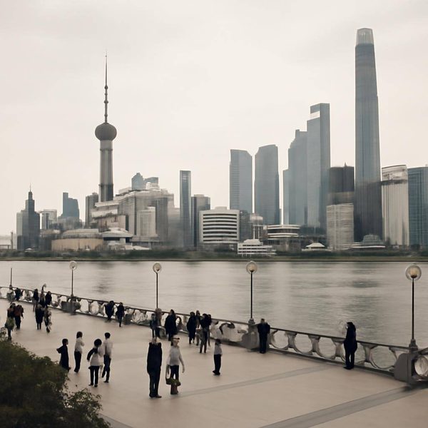
The Bund was ten minutes' walk south. It was a November morning, overcast but dry — a good season for this, past the heat of summer and comfortably before the New Year crowds. The promenade was busy but not oppressive. Across the Huangpu, the towers of Lujiazui stood in the flat morning light: the Oriental Pearl Tower in its particular shade of rose-grey, the Shanghai Tower rising behind it — China's tallest building, a twisted glass form that changes profile as you move along the waterfront. The facades on the western bank were something else entirely: Neoclassical, Baroque Revival, the old Customs House with its clock tower. The Shanghai Municipal Government's designation of this stretch as a Historical and Cultural Block is not an exaggeration.
At the northern end of the promenade, Garden Bridge — Waibaidu Bridge, completed in 1907, the first all-steel bridge built in China — crossed the mouth of Suzhou Creek. Below it, the creek ran dark toward the west, carrying the smell of the city's older, less visible waterways. On the far side, Huangpu Park occupied its triangular wedge of ground at the confluence: Shanghai's oldest public park, not grand, not particularly green in November, but carrying a specific weight of history that the larger parks in the city's interior do not.
The metro again, later, toward the south. Line 1 to Changshu Road and then on foot into the former French Concession. The plane trees along Fuxing Road had held most of their leaves. This is a different city from the Bund — quieter in register, more residential in texture, the lane houses set back from streets that were built for a different scale of traffic. Tianzifang, when you found it through a gap in the shopfronts on Taikang Road, was exactly what its reputation suggested: a network of converted shikumen lanes turned cafe and studio enclave, narrow enough that two people walking in opposite directions require a small negotiation at every turn. On a weekday morning it was manageable. The afternoon would be different.
The day's last stop was People's Square and the Shanghai Museum. The collection spans bronzes from the Shang and Zhou dynasties, Song ceramics, Ming furniture, and calligraphy scrolls that require a kind of slowing down that the rest of the city does not ask of you. It is the right place to end a long day of movement — a building where the pace is set by the objects, not the city outside.
Getting back to the accommodation was straightforward. Shanghai's metro closes around 11 pm on weekdays; on a Friday, the window is longer. The Easy Go platform — the city's integrated digital transport hub for international visitors, covering metro, bus, ferry and taxi — had made the day's navigation manageable from the start. For a city of 24 million, it moved with surprising legibility.
Practical notes: The Maglev from Pudong Airport to Longyang Road takes approximately eight minutes; transfer to the metro at Longyang Road. The metro generally opens at 5:30 am and closes around 11 pm weekdays, with extended hours on Fridays and Saturdays. Current schedules and route maps are at service.shmetro.com/en. The Bund promenade is freely accessible at all hours. Yu Garden charges admission; confirm hours before visiting. The Shanghai Museum is in People's Square.
Frequently Asked Questions
Can I use this Shanghai story as practical travel advice?
Use it as orientation and atmosphere, not as a live timetable or operating guide. Check the linked sources for current transport, access and opening details before travelling.
Is Eight Minutes at 430 km/h: Arriving in Shanghai a real first-hand trip?
No. It is a fictional arrival story built from source-backed facts, named places and route evidence. Use it for orientation and atmosphere, then use the linked sources for live transport decisions.
What does this route help visitors understand about Shanghai?
It turns source-backed places, route anchors and local context into a readable visitor route, so the story supports the main guide rather than replacing practical planning.
This is a fictional visitor story generated from source-backed place facts, image evidence and visitor-feel signals. It is not a first-hand WorldTownGuide visit. Named places, routes and historical references are source-backed; the visitor character and narrative events are invented.
Sources: Explore Shanghai's public transport system - english.shanghai.gov.cn • Transportation - english.shanghai.gov.cn • SHANGHAI CHINA - service.shanghai.gov.cn • Waibaidu Bridge - Wikipedia • The Bund Historical and Cultural Block - Shanghai Municipal Government • Tianzifang - Wikipedia